
Gunnerside in Swaledale is one of a chain of small picturesque Dales villages that lay along the B6270 and the River Swale. This month's MDB walk starts from the village and leads up Gunnerside Gill. The Gill is the scene of huge historical industrial activity as it was, during the eighteenth and nineteenth centuries, the base of extensive lead mining and is the home of a number of separate mines. It's hard to believe that the valley would have once been a busy hive of activity and the associated sounds of heavy industry would have filled what is now a perfectly peaceful environment, with only the sound of Gunnerside Beck and the odd bleat of a native Swaledale Ram filling the air today.

When I arrived the weather, which remained all day, was dry but overcast. I found a roadside spot to park, I booted and brewed up, checked over my OL30 map and set off in search of the Kings Head pub, not for a cheeky pint but the walk starts over the road, down a beck side track. The first footpath sign I notice is built into a wall and directs you to the right and up a few small steps and on.

The walk out of the village, in the first part takes you across a pasture. Looking back towards Gunnerside.

Gunnerside Beck.

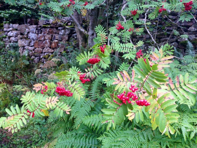
Beautiful red, jewel like Rowan berries were abundant on every Mountain Ash (Sorbus aucupaira) I passed.
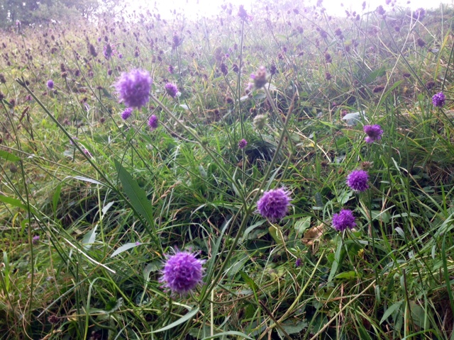
Another plant highlight was an abundance of the lovely lilac blue Devil's-bit Scabious (Succisa pratensis).
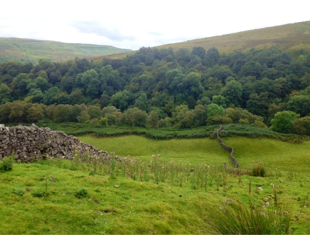
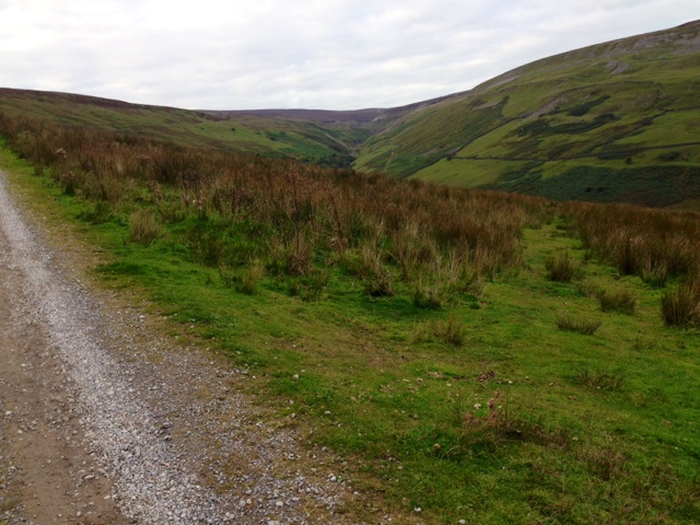
The well trodden path led over a series of fields and then into Birkbeck Wood with views up over the valley pastures.

The path continues to take you along parallel with the beck, or as I did you can choose to climb out of the valley and gain some height at this point in the direction of Winterings farmstead.

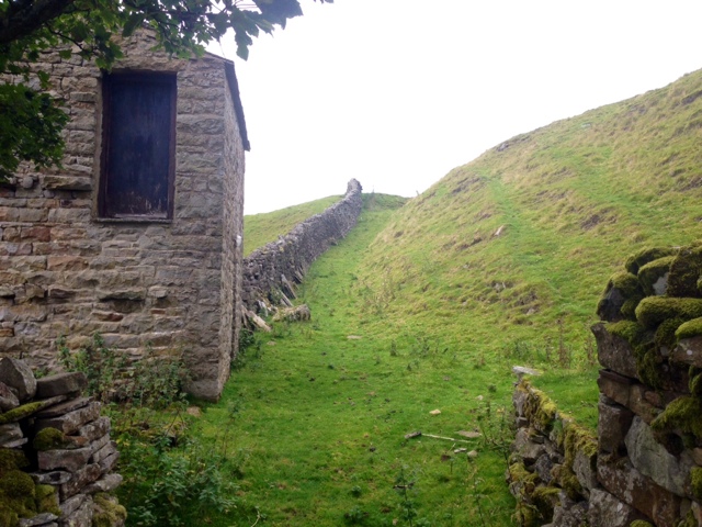
The path leads beside a drystone wall. Looking back towards the wooded section of Gunnerside Gill.

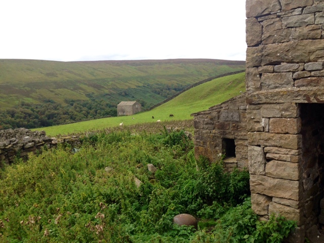
The view towards Winterings.

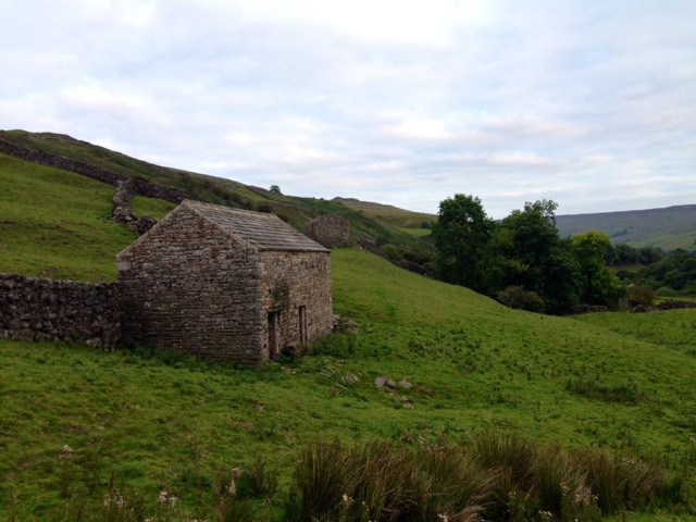
The path snakes around the buildings of Winterings and emerges at the rear of the smallest barn building and at the back of a drystone wall.
You cross over pastureland following a line of drystone walls....

And crossing through three.

Swaledales... The local breed.

The beck comes back into view.

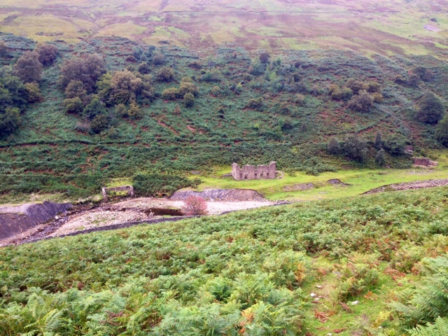
At Middle Bank looking over the beck to Sir Francis Level and the derelict Mine office building.
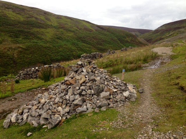
I found a large helpful cairn at the junction of the footpath and bridleway.
Bunton Mine was in sight.

Bunton Level.

I soon reached the remnants of the water wheel at Bunton Mine. Looking over the valley towards Lowanthwaite Mine.

Bunton Mine, looking back.

The path continued around the base of High Gorton.

The turning point in the walk, Blakenthwaite Mine Smelt Mill and Peat Store was fascinating to explore.
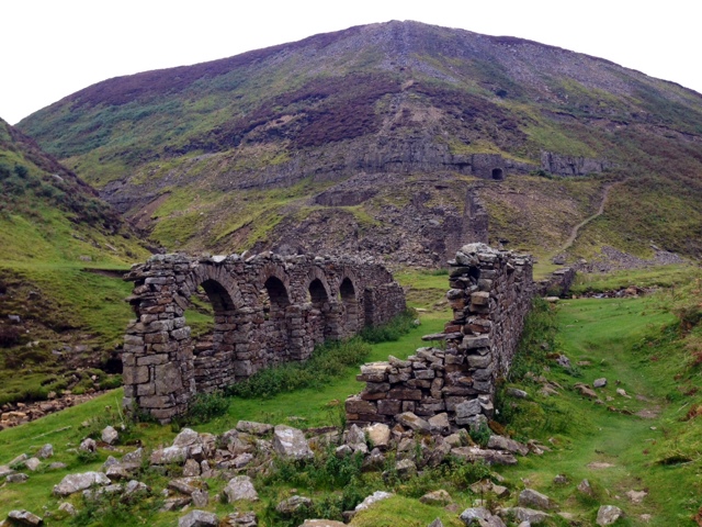

The Kiln.

Time to rest MDB while I survey the halfway point.


The path back towards Gunnerside is broad and well made and offers views across the valley.

I pass the path up to Lowanthwaite.

The view over to Bunton Mine and the incredibly scarred landscape.

The expansive views down the valley towards Gunnerside are spectacular.

The path to Botcher Gill gate

Botcher Gill waterfalls.

The mosaic of pastureland, drystone walls and barns of Winterings.

Continuing along until I reached a worn grass path that took me downwards and back on myself.
The grassy path took me into a sparsely wooded section, with hints of early autumn.


To Sir Francis Level and the disused Mine Office buildings I saw earlier over the beck.... I enjoyed exploring these buildings.


I found a place to cross over the beck and rejoined the beck side path,thought the wood and over the pastures, returning back into Gunnerside.


Before completing the walk I did climb back up the valley to get a look towards Gunnerside village and Blea Barf.

Back at the car I checked my map again as I knew I'd be back at some point to connect up a larger walk from neighbouring village, Muker.
Before I sign off I have to thank my super talented friend Rick Cobbold for making this amazingly detailed and beautifully done MDB inspired artwork.... I'm blown away, it's brilliant, thank you! If you want to see more of Rick's work click on the image in the side bar to be taken to his portfolio, or click on the links below:
https://rickcobboldillustration.carbonmade.com/
https://rickcobboldillustration.carbonmade.com/


And as always.... Phil, thank you.
Till next time.... Tight laces! MDBx