
My family and I have visited the lovely little Dales village of Malham a good number of times over the years; and independently The Tarn, Cove, Janet's Foss and Gordale Scar but strangely we have never connected them up and walked what many label as one of the quintessential Yorkshire Dales Classics. This is Limestone Landscape and the very best there is, with fields, barns and drystone walls everywhere. The route is punctuated with geological wonders and is easy to follow.
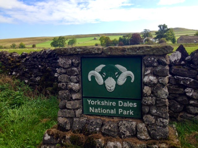
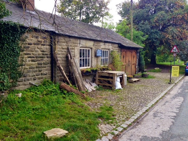
I started my day parked on the road side just outside Malham, once I was booted up I set off into the village. The walk starts at the rear of the Village Smithy, over a little stone clapper bridge that spans Malham Beck.

Once over, bear right and join the Pennine Way, carry along for a short section until a finger post guides you to the left in the direction of Janet's Foss. The path then takes you through fields, beside drystone walls and on into a woodland.

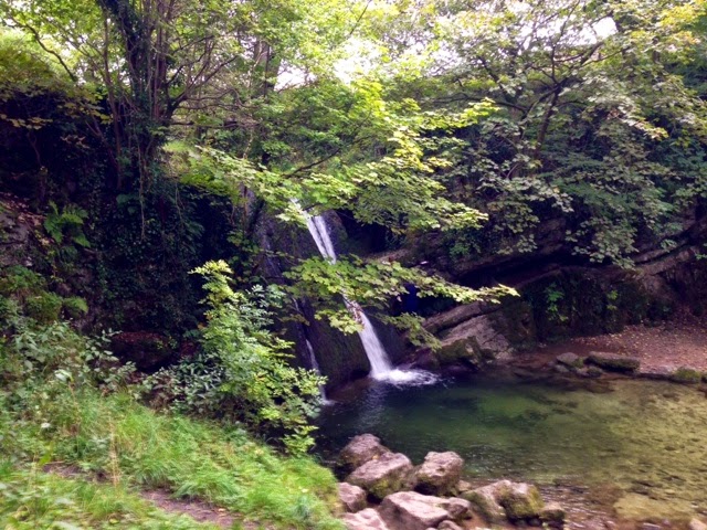
Janet's Foss, a small waterfall, can be found in a clearing at the far end of the woodland. The legendary magic of this spot is some what ruined due to its popularity, it is always very busy as it can be readily accessed by many. It is worth a visit because it is a very attractive feature and it is on the route.
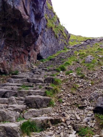
The obvious path carries you out of the woodland and towards a road, cross the road, turn right carry on a short way, take a left on to what is at first a track on an open field campsite. The track becomes a path that takes you into a dramatic limestone ravine, the gentle slopes of limestone scree soon become towering stone faces. As you take a right into the base of Gordale Scar you will find a much larger and more impressive waterfall.


The limestone faces were strung up with climbers rope and many were performing some impressive climbing moves. The climbing I had come to do was not the walls but the waterfall, however my dizzying fear of heights caused me to feel somewhat anxious about this part of the walk. Fortunately I had been given some brilliant tips and advice by my great mate Phil which proved to be invaluable, thanks so much! There are plenty of tips online as to how to tackle Gordale, I was glad that the volume of water, on the day, for me, was low.

The first of the day's two MDB shots, partway up Gordale, notice the less than relaxed position here.
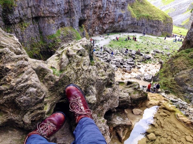

Carrying on up the waterfall system.

Phew, at the top!!!

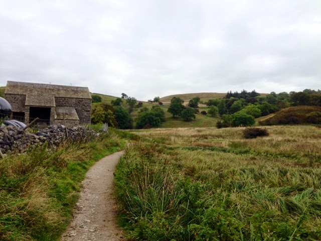
Once I had had some refreshment, a good brew stop, I continued along toward Malham Tarn passing sections of limestone pavement and open grassland.
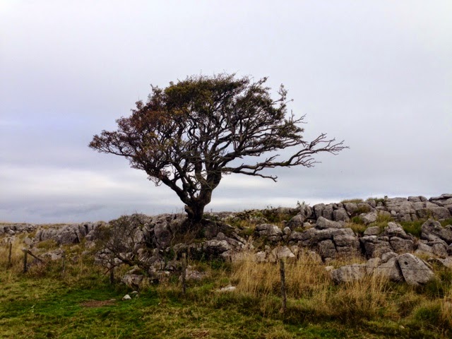
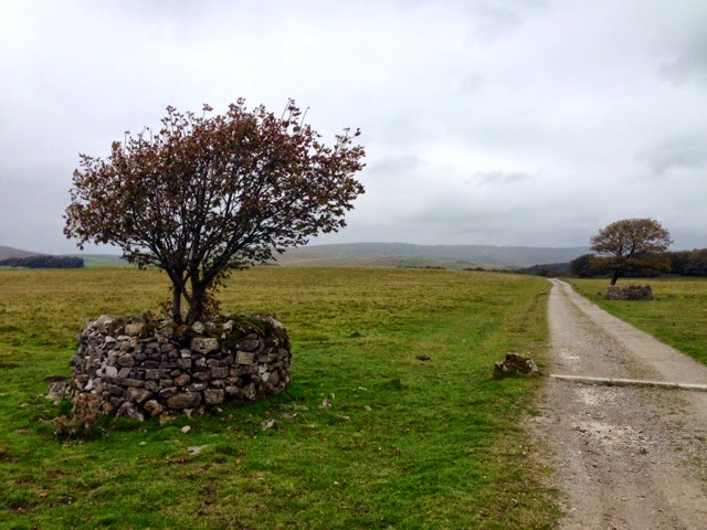
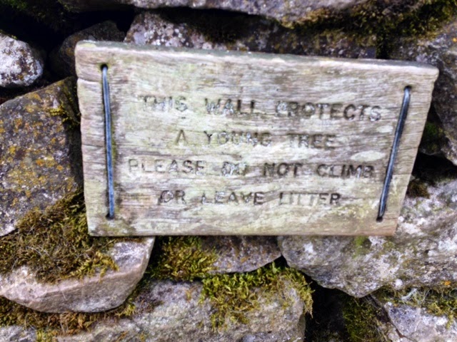
The path takes you towards a road, turn right onto a track and continue along. Carry on straight ahead when you get to a crossroad, a finger post gives a clear direction to Malham Tarn. Along this track you will see a few little drystone wall enclosures with small wind-pruned trees, I was amazed to see from the sign attached to one of these enclosures that they were constructed to protect a small tree. I am always pleased to see tree planting efforts but what irks me is that the tree growing inside these impressive fortifications is a Sycamore (Acer pseudoplatanus) a British non-native! A tree that is hardy but supports very little and is commonly seen as a weed. A better, more suitable choice of tree could have been made in my opinion especially as Malham Tarn, a National Nature Reserve holds biological SSSI (Site of Special Scientific Interest) and Ramsar status.
Malham Tarn is also, amazingly, being 377m (1,237ft) above sea level England's highest lake. I have checked this but if anyone knows any differently please comment. I assumed a body of water in the Lake District would have been the rightful owner of this title. The Tarn has been a popular spot for Trout Anglers for many years until, I remember Dad telling me, The Tarn became an un stocked fishery and the only fishing tickets available would be for 'catch-and-realease' from unpowered (rowing) boats. As Dad said "a lot of effort for no tea!" He concluded that a trip to The Tarn, was indeed, worth the effort!


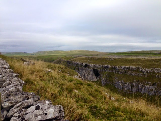
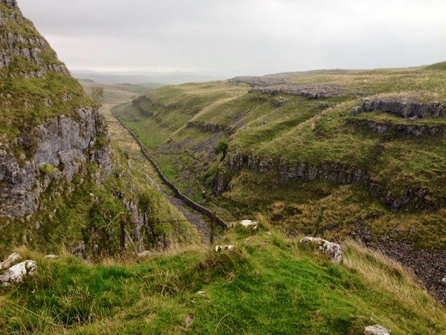
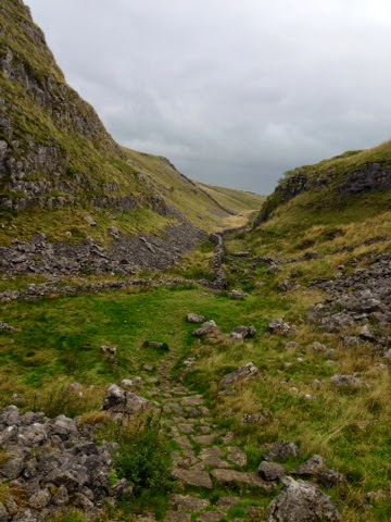
The path takes you away from The Tarn at Tarn Foot and you make your way towards a small car park. Cross the road and though a gate following a finger post guiding you onto another section of the Pennine Way. The route starts in a field, follows along a wall and out into another limestone ravine.


You carry along this very rocky path, when you round the bend at Comb Hill you get a glimpse of the lower section of the walk.
The path leads down to a style and a wall where the path runs parallel.


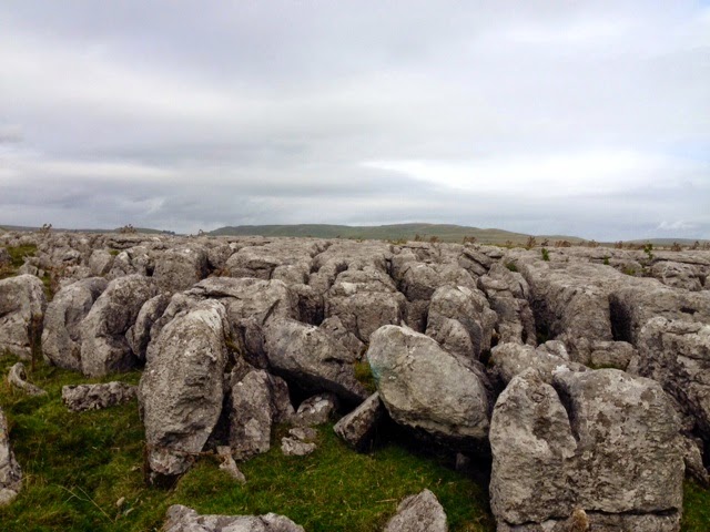
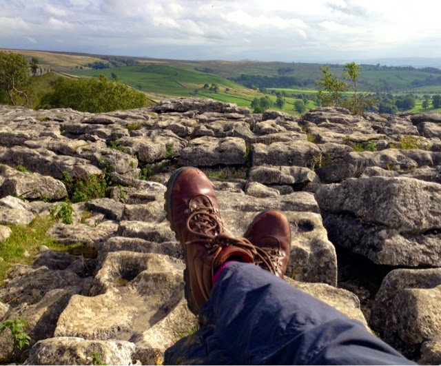
Soon you will be on the Malham Cove's Limestone Pavement, made up of an amazing mosaic of Clints (rocks) and Grykes (gaps). I had forgotten that some of the Clints moved, and again as I was giving my Vertigo a try I got a bit of a wobble near the edge as I was photographing the beautiful view.


I decided a safer seated position was a better bet to admire the view and rest MDB.
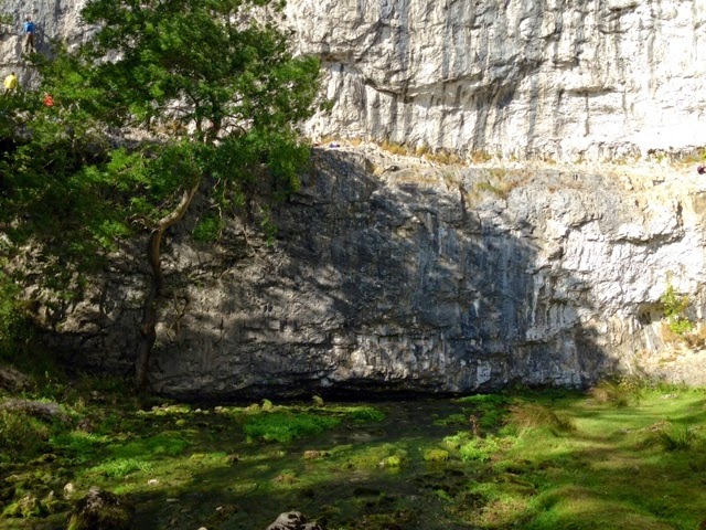
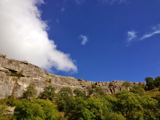
When I had made my way down I walked into The Cove, where the climbers were out in force again. One thing I have noticed along the whole route are the very low water levels in the becks, The Tarn and The Cove, I understand this is a national issue owing to this year's extended dry weather.

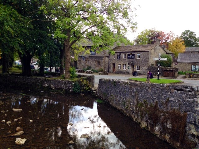
The well made path from The Cove back towards the village of Malham is a Dales treat, following the beck, drystone walls and little bridges.

Malham has a number of good pubs and cafés, perfect for a little refreshment before setting away.
I am so pleased I have been able to test a personal fear and win, while finally connecting up all these great Yorkshire geological features in MDB. A grand day out, in a word.... Classic!
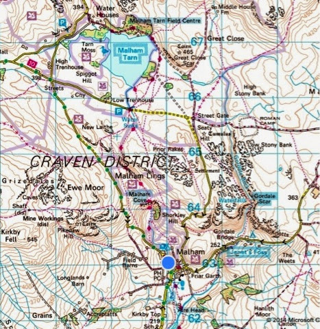
Map: Bing and Ordnance Survey
Till next time.... Tight laces! x